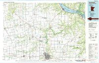
1985 Map of Rochester
USGS Topo · Published 1985About this map
Rochester stands as the central hub of this 1985 survey, surrounded by the sprawling Richard J Dorer Memorial Hardwood State Forest and a landscape defined by the intricate branching of the Zumbro River. The map captures the city’s mid-1980s expansion, featuring Rochester Community College and Olmsted Community Hospital amidst a network of regional settlements like Kasson and Zumbrota. Along the eastern edge, the Mississippi River widens into Lake Pepin, where the Milwaukee St Paul and Pacific rail line skirts the shoreline through Wabasha and Reads Landing.
Find a feature on this map
149 named features on this map. Tap any name to fly to it.
Don’t see what you’re looking for? This feature index may not catch every label — zoom into the map to look around manually.
Map Details
Editions of this 1985 Rochester Map
This is the sole edition of this map. No revisions or reprints were ever made.
Other maps of this area

1929 · Durand
USGS Topo · 1:62,500

1932 · Cochrane
USGS Topo · 1:62,500

1932 · Wabasha
USGS Topo · 1:62,500

1932 · Durand
USGS Topo · 1:62,500

1932 · Alma
USGS Topo · 1:62,500

1934 · Plainview
USGS Topo · 1:62,500

1934 · Cochrane
USGS Topo · 1:62,500

1935 · Rochester
USGS Topo · 1:48,000

1935 · Arkansaw
USGS Topo · 1:48,000

1937 · Cochrane
USGS Topo · 1:62,500