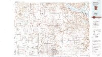
1989 Map of Rochester
USGS Topo · Published 1989About this map
Rochester serves as the regional anchor of this late-century landscape, where the agricultural plains of southeastern Minnesota meet the dramatic bluffs of the Mississippi River valley. The map documents a mature transport network dominated by major corridors like U.S. 52 and U.S. 14, alongside the historic routes of the Chicago and North Western and Soo Line railroads. To the north and east, the terrain shifts into the complex coulees and ridges of the Richard J Dorer Memorial Hardwood State Forest, bordering the wide expanse of Lake Pepin. The hydrology is defined by the branching system of the Zumbro River, including its North, Middle, and South forks, which carve through townships like Mazeppa, Zumbrota, and Mantorville. This 1980s era survey captures these communities at a point of established growth, balancing industrial rail access with the preservation of riverfront and forest lands.
Find a feature on this map
141 named features on this map. Tap any name to fly to it.
Don’t see what you’re looking for? This feature index may not catch every label — zoom into the map to look around manually.
Map Details
Editions of this 1989 Rochester Map
2 editions found
Other maps of this area

1929 · Durand
USGS Topo · 1:62,500

1932 · Cochrane
USGS Topo · 1:62,500

1932 · Wabasha
USGS Topo · 1:62,500

1932 · Durand
USGS Topo · 1:62,500

1932 · Alma
USGS Topo · 1:62,500

1934 · Plainview
USGS Topo · 1:62,500

1934 · Cochrane
USGS Topo · 1:62,500

1935 · Rochester
USGS Topo · 1:48,000

1935 · Arkansaw
USGS Topo · 1:48,000

1937 · Cochrane
USGS Topo · 1:62,500