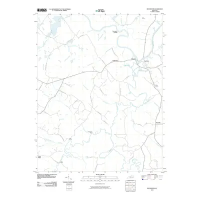
2010 Map of Rochester
USGS Topo · Published 2010About this map
The Green River and Mud River converge at Rochester, defining a landscape of complex waterways and floodplain ecology. This riverine environment is punctuated by oxbow-like features such as Town Lake and Bridge Lake, while the larger drainage basin includes Andrews Run, Jacobs Creek, and the winding path of Hooper Creek. The map documents a predominantly rural infrastructure where transportation and settlement patterns are closely tied to the water, visible in historic river access points like Davenport Landing and the prominence of river-oriented crossings such as Ward Bridge and Clark Bridge.
Find a feature on this map
50 named features on this map. Tap any name to fly to it.
Don’t see what you’re looking for? This feature index may not catch every label — zoom into the map to look around manually.
Map Details
Editions of this 2010 Rochester Map
This is the sole edition of this map. No revisions or reprints were ever made.
Other maps of this area

1909 · Hartford
USGS Topo · 1:62,500

1909 · Central City
USGS Topo · 1:62,500

1911 · Drakesboro
USGS Topo · 1:48,000

1911 · Dunmor
USGS Topo · 1:48,000

1913 · Drakesboro
USGS Topo · 1:62,500

1914 · Dunmor
USGS Topo · 1:62,500

1953 · Drakesboro
USGS Topo · 1:24,000

1953 · Rosewood
USGS Topo · 1:24,000

1953 · Central City East
USGS Topo · 1:24,000

1953 · Dunmor
USGS Topo · 1:24,000