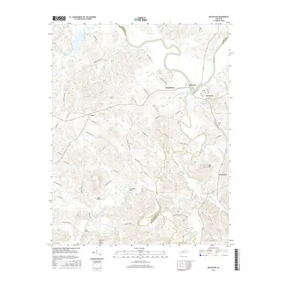
2016 Map of Rochester
USGS Topo · Published 2016About this map
The Green River and Mud River converge in this corner of Kentucky, defining a landscape of deep meanders and alluvial bottomlands along the borders of Butler, Muhlenberg, and Ohio Counties. At the heart of the river traffic stands the Rochester Lock near the town of Rochester, where the waterway’s industrial legacy is still visible. The terrain rises sharply from the riverbanks into prominent high points like Reed Hill and Chestnut Oak Ridge, while numerous creeks and branches, such as Andrews Run and Daniels Br, carve through the surrounding timberland. This 2016 survey documents the enduring layout of rural settlements like Ennis, Skilesville, and Huntsville. For those tracing family histories or land use, the map details many local access points and landmarks including Taylor Cem, Midway Cem, and old crossings like Ward Bridge and Clark Bridge.
Find a feature on this map
71 named features on this map. Tap any name to fly to it.
Don’t see what you’re looking for? This feature index may not catch every label — zoom into the map to look around manually.
Map Details
Editions of this 2016 Rochester Map
This is the sole edition of this map. No revisions or reprints were ever made.
Other maps of this area

1909 · Hartford
USGS Topo · 1:62,500

1909 · Central City
USGS Topo · 1:62,500

1911 · Drakesboro
USGS Topo · 1:48,000

1911 · Dunmor
USGS Topo · 1:48,000

1913 · Drakesboro
USGS Topo · 1:62,500

1914 · Dunmor
USGS Topo · 1:62,500

1953 · Drakesboro
USGS Topo · 1:24,000

1953 · Rosewood
USGS Topo · 1:24,000

1953 · Central City East
USGS Topo · 1:24,000

1953 · Dunmor
USGS Topo · 1:24,000