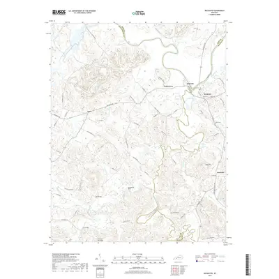
2019 Map of Rochester
USGS Topo · Published 2019About this map
The Green River carves a winding path through this corner of Kentucky, serving as a natural boundary between Muhlenberg, Ohio, and Butler counties. Near the town of Rochester, the river's influence on local geography is evident in the cluster of water features like Bridge Lake and Town Lake, and the nearby settlement of Skilesville. The landscape transitions into the hills of Reed Hill and Chestnut Oak Ridge, where a network of rural roads such as Mud River Mine Rd and Huntsville-Quality Rd connect small communities like Huntsville and Ennis.
Find a feature on this map
75 named features on this map. Tap any name to fly to it.
Don’t see what you’re looking for? This feature index may not catch every label — zoom into the map to look around manually.
Map Details
Editions of this 2019 Rochester Map
This is the sole edition of this map. No revisions or reprints were ever made.
Other maps of this area

1909 · Hartford
USGS Topo · 1:62,500

1909 · Central City
USGS Topo · 1:62,500

1911 · Drakesboro
USGS Topo · 1:48,000

1911 · Dunmor
USGS Topo · 1:48,000

1913 · Drakesboro
USGS Topo · 1:62,500

1914 · Dunmor
USGS Topo · 1:62,500

1953 · Drakesboro
USGS Topo · 1:24,000

1953 · Rosewood
USGS Topo · 1:24,000

1953 · Central City East
USGS Topo · 1:24,000

1953 · Dunmor
USGS Topo · 1:24,000