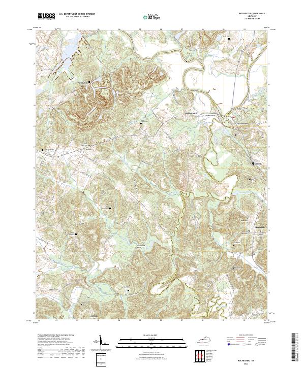
2022 Map of Rochester
USGS Topo · Published 2022About this map
The Mud River meanders toward its confluence with the Green River, defining a landscape where the borders of Butler, Muhlenberg, and Ohio Counties converge. Near the town of Rochester, the river system creates a network of backwaters and lakes, including Town Lake and Bridge Lake. This area is marked by a high density of rural burial grounds and places of worship that serve as vital touchstones for family historians, from the Mud River Mine Cem in the south to Taylor Cem in the north.
Find a feature on this map
98 named features on this map. Tap any name to fly to it.
Don’t see what you’re looking for? This feature index may not catch every label — zoom into the map to look around manually.
Map Details
Editions of this 2022 Rochester Map
This is the sole edition of this map. No revisions or reprints were ever made.
Other maps of this area

1909 · Hartford
USGS Topo · 1:62,500

1909 · Central City
USGS Topo · 1:62,500

1911 · Drakesboro
USGS Topo · 1:48,000

1911 · Dunmor
USGS Topo · 1:48,000

1913 · Drakesboro
USGS Topo · 1:62,500

1914 · Dunmor
USGS Topo · 1:62,500

1953 · Drakesboro
USGS Topo · 1:24,000

1953 · Rosewood
USGS Topo · 1:24,000

1953 · Central City East
USGS Topo · 1:24,000

1953 · Dunmor
USGS Topo · 1:24,000