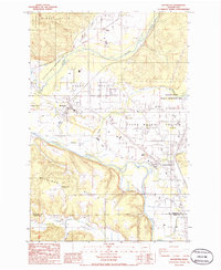
1986 Map of Rochester
USGS Topo · Published 1986About this map
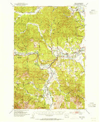
Mima Prairie and its surrounding lowlands define this landscape in the mid-1980s, where the glacial legacy of the Pacific Northwest is evident in the unique topography north of Rochester. The convergence of the Black River and the Chehalis River shapes the southern geography, supporting a mix of agricultural land and managed wilderness. The map documents several important conservation and timber zones, including the Capitol State Forest and the Scatter Creek Wildlife Recreation Area. For those investigating local heritage, the Fort Henness Historical Site and the Mima Cem provide specific points of reference near Grand Mound. The area's resource-based economy is visible through numerous Gravel Pits and the extensive Black River Habitat Management Area, reflecting a period of transition between industrial use and environmental preservation.
Find a feature on this map
31 named features on this map. Tap any name to fly to it.
Don’t see what you’re looking for? This feature index may not catch every label — zoom into the map to look around manually.
Map Details
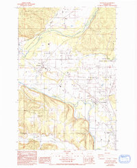
Editions of this 1986 Rochester Map
2 editions found
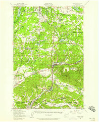
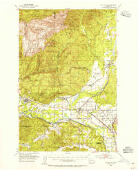
Other maps of this area

1916 · Chehalis
USGS Topo · 1:125,000

1940 · Tenino
USGS Topo · 1:62,500

1941 · Meskill
USGS Topo · 1:62,500

1941 · Gate
USGS Topo · 1:62,500

1944 · Tenino
USGS Topo · 1:62,500
1949 · Tenino
USGS Topo · 1:62,500

1953 · Hoquiam
USGS Topo · 1:250,000
1953 · Rochester
USGS Topo · 1:62,500
1953 · Adna
USGS Topo · 1:62,500
1954 · Centralia
USGS Topo · 1:62,500