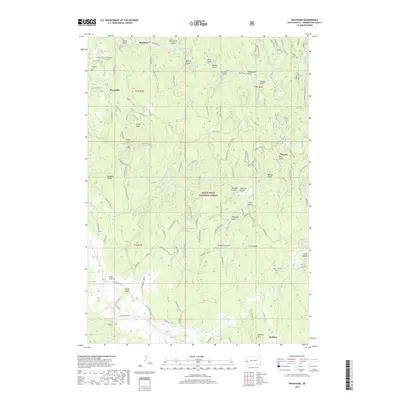
2017 Map of Rochford
USGS Topo · Published 2017About this map
Rochford and its surrounding mountain gulches define this portion of the Black Hills National Forest during the early 21st century. The map centers on a landscape deeply etched by drainage systems like Silver Creek and Rapid Creek, where early settlements and ranching outposts like Myersville and Mystic took root. Genealogists can locate the Rochford Cemetery on the northwestern heights, while topography enthusiasts will note prominent elevations such as Castle Peak and Signal Knob. The intricate network of Forest Service roads, including Golden West Road and Rochford Road, illustrates the modern accessibility of these remote areas. Many of the features, such as Moonshine Gulch, Bloody Gulch, and Hoodoo Gulch, preserve the colorful nomenclature of the region's prospecting and ranching history, even as the landscape serves contemporary forestry and recreation.
Find a feature on this map
70 named features on this map. Tap any name to fly to it.
Don’t see what you’re looking for? This feature index may not catch every label — zoom into the map to look around manually.
Map Details
Editions of this 2017 Rochford Map
This is the sole edition of this map. No revisions or reprints were ever made.
Other maps of this area

1894 · Deadwood
USGS Topo · 1:125,000

1896 · Harney Peak
USGS Topo · 1:125,000

1901 · Harney Peak
USGS Topo · 1:125,000

1901 · Deadwood
USGS Topo · 1:125,000

1916 · Deadwood
USGS Topo · 1:125,000

1953 · Nemo
USGS Topo · 1:24,000

1953 · Rapid City
USGS Topo · 1:250,000

1954 · Silver City
USGS Topo · 1:24,000

1954 · Hill City
USGS Topo · 1:24,000

1955 · Hot Springs
USGS Topo · 1:250,000