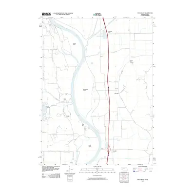
2010 Map of Rock Bluff
USGS Topo · Published 2010About this map
The Missouri River carves a serpentine path through this borderland between Nebraska and Iowa, defining a landscape of shifting islands and bottomlands. Several large landmasses sit within the river's influence, including Tobacco Island, Noddleman Island, and Goose Island, while the western banks are marked by prominent elevations like Queen Hill and King Hill. These heights contrast sharply with the low-lying eastern plains where the Mills Fremont Ditch and Honey Slough manage the drainage of the fertile valley floor.
Find a feature on this map
65 named features on this map. Tap any name to fly to it.
Don’t see what you’re looking for? This feature index may not catch every label — zoom into the map to look around manually.
Map Details
Editions of this 2010 Rock Bluff Map
This is the sole edition of this map. No revisions or reprints were ever made.
Other maps of this area

1935 · Nehawka
USGS Topo · 1:48,000

1940 · Nehawka
USGS Topo · 1:62,500

1954 · Omaha
USGS Topo · 1:250,000

1955 · Nebraska City
USGS Topo · 1:250,000

1956 · Glenwood
USGS Topo · 1:24,000

1956 · Murray
USGS Topo · 1:24,000

1956 · Rock Bluff
USGS Topo · 1:24,000

1956 · Plattsmouth
USGS Topo · 1:24,000

1956 · Pacific Junction
USGS Topo · 1:24,000

1957 · Nebraska City
USGS Topo · 1:250,000