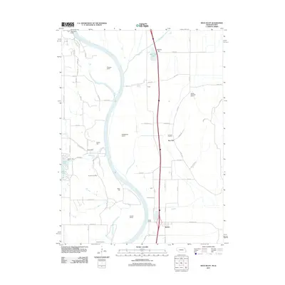
2011 Map of Rock Bluff
USGS Topo · Published 2011About this map
The Missouri River carves a winding path through this 2011 survey, defining the borderlands between Nebraska and Iowa. On the western bank, the terrain is punctuated by significant elevations like Queen Hill and King Hill, while the eastern floodplain is marked by drainage systems such as Keg Creek and Honey Slough. This area preserves several family and community landmarks, including the Rock Bluff Cemetery and Van Eaton Cemetery, which offer valuable coordinates for genealogical research. Large river features like Tobacco Island, Noddleman Island, and Goose Island illustrate the shifting nature of the river channel over time. Small settlements and named locales such as Rock Bluff, Burr Oak, and Bartlett are connected by a network of rural routes and the modern Interstate system, while Sargents Spur and Egypt hint at localized points of historical interest in the agricultural landscape.
Find a feature on this map
71 named features on this map. Tap any name to fly to it.
Don’t see what you’re looking for? This feature index may not catch every label — zoom into the map to look around manually.
Map Details
Editions of this 2011 Rock Bluff Map
This is the sole edition of this map. No revisions or reprints were ever made.
Other maps of this area

1935 · Nehawka
USGS Topo · 1:48,000

1940 · Nehawka
USGS Topo · 1:62,500

1954 · Omaha
USGS Topo · 1:250,000

1955 · Nebraska City
USGS Topo · 1:250,000

1956 · Glenwood
USGS Topo · 1:24,000

1956 · Murray
USGS Topo · 1:24,000

1956 · Rock Bluff
USGS Topo · 1:24,000

1956 · Plattsmouth
USGS Topo · 1:24,000

1956 · Pacific Junction
USGS Topo · 1:24,000

1957 · Nebraska City
USGS Topo · 1:250,000