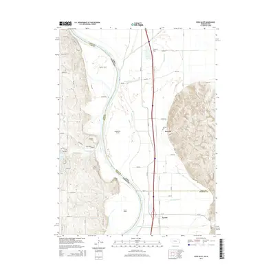
2014 Map of Rock Bluff
USGS Topo · Published 2014About this map
The Missouri River serves as the shifting border between Iowa and Nebraska in this 2014 survey, carving a complex path through the floodplain where river-sculpted features like Tobacco Island, Noddleman Island, and Goose Island define the riparian landscape. The Missouri valley is flanked by significant elevation changes, notably at Queen Hill and King Hill, which overlook the river's winding course. This modern perspective on the borderlands captures the persistence of small settlements and transportation corridors, with Sargents Spur and Burr Oak situated in the flat agricultural lands of the Iowa side.
Find a feature on this map
75 named features on this map. Tap any name to fly to it.
Don’t see what you’re looking for? This feature index may not catch every label — zoom into the map to look around manually.
Map Details
Editions of this 2014 Rock Bluff Map
This is the sole edition of this map. No revisions or reprints were ever made.
Other maps of this area

1935 · Nehawka
USGS Topo · 1:48,000

1940 · Nehawka
USGS Topo · 1:62,500

1954 · Omaha
USGS Topo · 1:250,000

1955 · Nebraska City
USGS Topo · 1:250,000

1956 · Glenwood
USGS Topo · 1:24,000

1956 · Murray
USGS Topo · 1:24,000

1956 · Rock Bluff
USGS Topo · 1:24,000

1956 · Plattsmouth
USGS Topo · 1:24,000

1956 · Pacific Junction
USGS Topo · 1:24,000

1957 · Nebraska City
USGS Topo · 1:250,000