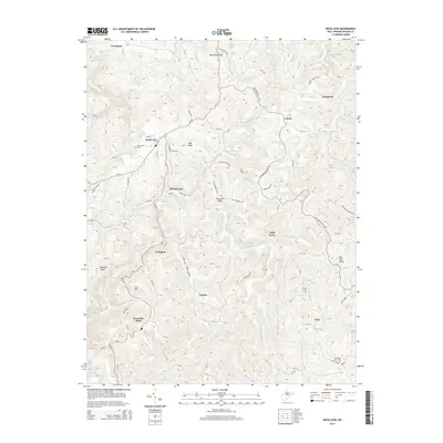
2014 Map of Rock Cave
USGS Topo · Published 2014About this map
Rock Cave serves as a central hub in this Appalachian landscape, where the headwaters of the Little Kanawha River and the W Fork River originate among high ridges. The settlement pattern follows the winding valley roads, notably WV-20, connecting historic hamlets like Arlington, Gaines, and Holly Grove. Genealogists will find significant local history at the Rock Cave Cem, Mt Zion Cem, and Pleasant Dale Cem. The terrain is defined by prominent elevations such as Bob Peak and Prit Mtn, which separate the many named runs and forks feeding the river systems. This 2014 representation captures the enduring rural character of Upshur County, showing a network of secondary routes like Alexander Helvetia Rd that have long served these high-country communities.
Find a feature on this map
96 named features on this map. Tap any name to fly to it.
Don’t see what you’re looking for? This feature index may not catch every label — zoom into the map to look around manually.
Map Details
Editions of this 2014 Rock Cave Map
This is the sole edition of this map. No revisions or reprints were ever made.
Other maps of this area

1893 · Buckhannon
USGS Topo · 1:125,000

1896 · Buckhannon
USGS Topo · 1:125,000

1897 · Buckhannon
USGS Topo · 1:125,000

1912 · Sago
USGS Topo · 1:48,000

1912 · Crawford
USGS Topo · 1:48,000

1913 · Hacker Valley
USGS Topo · 1:48,000

1913 · Pickens
USGS Topo · 1:48,000

1914 · Sago
USGS Topo · 1:62,500

1914 · Crawford
USGS Topo · 1:62,500

1915 · Hacker Valley
USGS Topo · 1:62,500