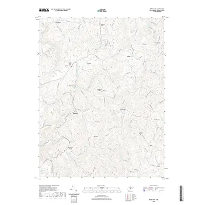
2019 Map of Rock Cave
USGS Topo · Published 2019About this map
The Little Kanawha River carves through the heart of this Upshur County landscape, anchoring a network of small settlements and high ridges in the early 21st century. The village of Rock Cave serves as a local hub, situated near the headwaters of Whites Camp Fork and Sand Run. The terrain is defined by prominent elevations such as Bob Peak and Prit Mtn, while agricultural flats like Buttonwood Flat suggest rare level ground amidst the steep draws. Historically-minded researchers can identify dozens of named drainages, including French Creek and Getout Run, which dictated the placement of early roads and farmsteads. Genealogical interest is centered on well-placed markers like Rock Cave Cemetery, Mount Zion Cemetery, and Pleasant Dale Cemetery, which sit alongside established routes like Holly Grove Road and the Main Exhibit Trail.
Find a feature on this map
115 named features on this map. Tap any name to fly to it.
Don’t see what you’re looking for? This feature index may not catch every label — zoom into the map to look around manually.
Map Details
Editions of this 2019 Rock Cave Map
This is the sole edition of this map. No revisions or reprints were ever made.
Other maps of this area

1893 · Buckhannon
USGS Topo · 1:125,000

1896 · Buckhannon
USGS Topo · 1:125,000

1897 · Buckhannon
USGS Topo · 1:125,000

1912 · Sago
USGS Topo · 1:48,000

1912 · Crawford
USGS Topo · 1:48,000

1913 · Hacker Valley
USGS Topo · 1:48,000

1913 · Pickens
USGS Topo · 1:48,000

1914 · Sago
USGS Topo · 1:62,500

1914 · Crawford
USGS Topo · 1:62,500

1915 · Hacker Valley
USGS Topo · 1:62,500