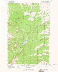
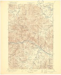
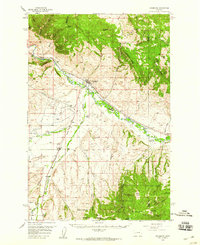
1967 Map of Rock Creek Lake
USGS Topo · Published 1970About this map
The high ridges of the Deerlodge National Forest dominate this 1967 field survey, revealing a landscape defined by both natural water features and early industrial irrigation efforts. Elevations rise significantly at Pikes Peak and Ballard Hill, while the interior terrain is marked by alpine basins like South America Park. The water systems here are notably complex, showing a history of hydraulic engineering through features like the Old China Ditch, Korrs and Bielenberg Ditch, and Pauly Ditch. These artificial waterways cut across the natural drainages of Willow Creek and Rock Creek, likely supporting mining or agricultural interests in the lower valleys. Remnants of extraction are visible at a lone Mine near Pikes Creek, while the central basin is anchored by the large expanse of Rock Creek Lake just below the Rock Creek Falls.
Find a feature on this map
35 named features on this map. Tap any name to fly to it.
Don’t see what you’re looking for? This feature index may not catch every label — zoom into the map to look around manually.
Map Details
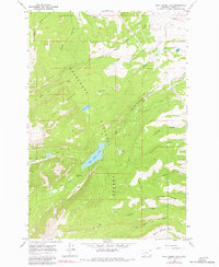
Editions of this 1967 Rock Creek Lake Map
2 editions found
Other maps of this area

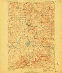
1889 · Helena
USGS Topo · 1:250,000

1893 · Helena
USGS Topo · 1:250,000

1899 · Helena
USGS Topo · 1:250,000

1903 · Helena
USGS Topo · 1:250,000
1908 · Philipsburg
USGS Topo · 1:125,000
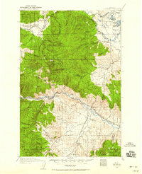
1919 · Drummond
USGS Topo · 1:125,000
1921 · Drummond
USGS Topo · 1:125,000

1947 · Butte
USGS Topo · 1:250,000

1958 · Butte
USGS Topo · 1:250,000
1958 · Drummond
USGS Topo · 1:62,500