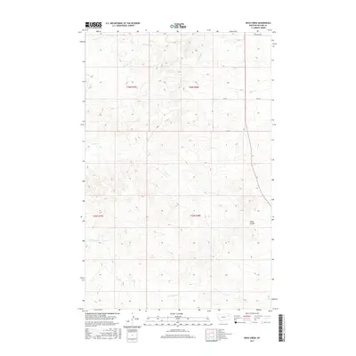
2017 Map of Rock Creek
USGS Topo · Published 2017About this map
Rock Cr and its network of ephemeral tributaries define this rural landscape in McCone County during the early 21st century. The drainage patterns across this high plains terrain are marked by numerous coulees and creeks, including Schwartz Cr in the north and the winding path of Long Branch Cr to the south. The map illustrates a strictly rectilinear township and range system, where section lines often dictate the placement of local thoroughfares like Sunnyside Rd and Jb Rd. This grid-based land division, shown across t26n r47e and surrounding townships, highlights the enduring influence of the Public Land Survey System on Montana’s ranching and agricultural geography. Scattered features like Gady Coulee and Nickwall Cr provide essential landmarks for navigating the undulating breaks that characterize this part of the Missouri River watershed.
Find a feature on this map
14 named features on this map. Tap any name to fly to it.
Don’t see what you’re looking for? This feature index may not catch every label — zoom into the map to look around manually.
Map Details
Editions of this 2017 Rock Creek Map
This is the sole edition of this map. No revisions or reprints were ever made.
Other maps of this area

1912 · Chelsea
USGS Topo · 1:62,500

1916 · Wolf Point
USGS Topo · 1:62,500

1954 · Glendive
USGS Topo · 1:250,000

1954 · Wolf Point
USGS Topo · 1:250,000

1957 · Glendive
USGS Topo · 1:250,000

1958 · Wolf Point
USGS Topo · 1:250,000

1958 · Glendive
USGS Topo · 1:250,000

1972 · Chelsea SW
USGS Topo · 1:24,000

1972 · Wolf Point
USGS Topo · 1:24,000

1972 · Macon
USGS Topo · 1:24,000