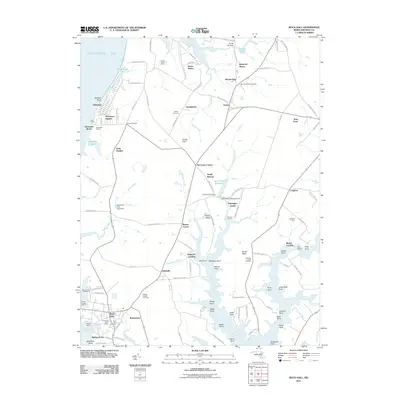
2011 Map of Rock Hall
USGS Topo · Published 2011About this map
Rock Hall and its surrounding Eastern Shore hamlets are defined by the intricate relationship between the Chesapeake Bay and the tidal creeks of Kent County. The landscape is characterized by established farmsteads like Remington Farms and Langford Farm, interspersed with historical burial grounds including Saint Pauls Cemetery and Wesley Chapel Cemetery. Waterfront industry and recreation are prominent along the western edge, where Tolchester Beach and Tolchester Marina overlook the bay, while the southern reach shows the cluster of Sharpstown and Hidden Acres near the Rock Hall Post Office.
Find a feature on this map
127 named features on this map. Tap any name to fly to it.
Don’t see what you’re looking for? This feature index may not catch every label — zoom into the map to look around manually.
Map Details
Editions of this 2011 Rock Hall Map
This is the sole edition of this map. No revisions or reprints were ever made.
Other maps of this area

1893 · North Point
USGS Topo · 1:62,500

1893 · Gunpowder
USGS Topo · 1:62,500

1898 · Tolchester
USGS Topo · 1:125,000

1900 · Betterton
USGS Topo · 1:62,500

1901 · Chestertown
USGS Topo · 1:62,500

1901 · Gunpowder
USGS Topo · 1:62,500

1903 · Tolchester
USGS Topo · 1:125,000

1904 · North Point
USGS Topo · 1:62,500

1908 · Tolchester
USGS Topo · 1:125,000

1920 · Chestertown
USGS Topo · 1:62,500