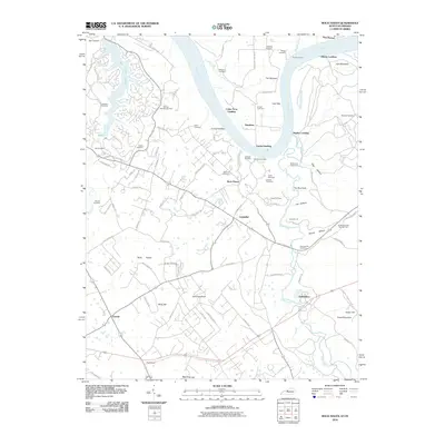
2010 Map of Rock Haven
USGS Topo · Published 2010About this map
The Ohio River carves a dramatic bend through this borderland, where the winding waterway passes The Narrows and several historical river access points including Hughes Landing, Gurley Landing, and Cedar Farm Landing. The terrain is defined by sharp elevation changes, from the riverside flats to the heights of Iron Mountain and Snow Mountain. Near the southern reaches, the community of Grahamton sits along the banks of Otter Creek, while the historic Doe Run Mill stands as a landmark of earlier industrial activity near the newer residential developments around Doe Valley Lake.
Find a feature on this map
101 named features on this map. Tap any name to fly to it.
Don’t see what you’re looking for? This feature index may not catch every label — zoom into the map to look around manually.
Map Details
Editions of this 2010 Rock Haven Map
This is the sole edition of this map. No revisions or reprints were ever made.
Other maps of this area

1909 · Kosmosdale
USGS Topo · 1:48,000

1912 · Kosmosdale
USGS Topo · 1:62,500

1931 · Corydon
USGS Topo · 1:62,500

1936 · Vine Grove
USGS Topo · 1:62,500

1941 · Ekron
USGS Topo · 1:62,500

1943 · Vine Grove
USGS Topo · 1:62,500

1946 · Rock Haven
USGS Topo · 1:24,000

1946 · Fort Knox
USGS Topo · 1:24,000

1946 · Vine Grove
USGS Topo · 1:24,000

1946 · Vine Grove
USGS Topo · 1:62,500