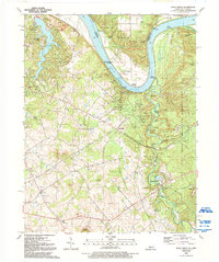
1991 Map of Rock Haven
USGS Topo · Published 1992About this map
Otter Creek meanders toward the Ohio River in this detailed survey, which illustrates the intersection of industrial utility and mid-century recreation. The landscape is defined by the significant infrastructure of the Doe Run Storage Field and the adjacent residential and leisure developments surrounding Doe Valley Lake. Several landings along the river, including Cedar Farm Landing and Hughes Landing, indicate the enduring importance of river access even as the interior terrain became dominated by the Fort Knox Military Reservation along the eastern boundary.
Find a feature on this map
74 named features on this map. Tap any name to fly to it.
Don’t see what you’re looking for? This feature index may not catch every label — zoom into the map to look around manually.
Map Details
Editions of this 1991 Rock Haven Map
This is the sole edition of this map. No revisions or reprints were ever made.
Other maps of this area

1909 · Kosmosdale
USGS Topo · 1:48,000

1912 · Kosmosdale
USGS Topo · 1:62,500

1931 · Corydon
USGS Topo · 1:62,500

1936 · Vine Grove
USGS Topo · 1:62,500

1941 · Ekron
USGS Topo · 1:62,500

1943 · Vine Grove
USGS Topo · 1:62,500

1946 · Rock Haven
USGS Topo · 1:24,000

1946 · Fort Knox
USGS Topo · 1:24,000

1946 · Vine Grove
USGS Topo · 1:24,000

1946 · Vine Grove
USGS Topo · 1:62,500