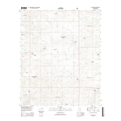
2014 Map of Rock House
USGS Topo · Published 2014About this map
Tonto National Forest defines the character of this landscape in central Arizona, where high desert elevations and deep drainages meet. The settlement of Rock House sits at the heart of a network of canyons and mesas, including Rock House Canyon and the prominent Pendleton Mesa to the northwest. This area is heavily defined by its scarce water sources, evidenced by the numerous named springs and tanks such as Middle Trap Spring, Dead Cow Spring, and Asbestos Spring that supported ranching and forest management. The presence of Lacey Forks Canyon and Willow Spring Canyon indicates a complex drainage system flowing through the rugged interior. These landforms, along with landmarks like Gunsight Butte and Castle Peak, provided critical orientation points in an era of forest navigation and early cattle grazing within the federal forest boundaries.
Find a feature on this map
99 named features on this map. Tap any name to fly to it.
Don’t see what you’re looking for? This feature index may not catch every label — zoom into the map to look around manually.
Map Details
Editions of this 2014 Rock House Map
This is the sole edition of this map. No revisions or reprints were ever made.
Other maps of this area

1886 · Holbrook
USGS Topo · 1:250,000

1893 · Holbrook
USGS Topo · 1:250,000

1922 · Chrysotile
USGS Topo · 1:125,000

1946 · Blue House Mtn
USGS Topo · 1:62,500

1949 · McFadden Peak
USGS Topo · 1:62,500

1950 · McFadden Peak
USGS Topo · 1:62,500

1951 · Blue House Mtn
USGS Topo · 1:62,500

1954 · Holbrook
USGS Topo · 1:250,000

1954 · Mesa
USGS Topo · 1:250,000

1957 · Mesa
USGS Topo · 1:250,000