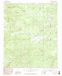
1986 Map of Rock House
USGS Topo · Published 1986About this map
Tonto National Forest and the Fort Apache Indian Reservation meet in this mid-1980s topographic study, characterized by a complex network of canyons and high mesas. The landscape is defined by its water sources, including numerous isolated springs such as Middle Trap Spring, Middleton Mesa Spring, and Dead Cow Spring that dot the high country. These points of water, along with named drainage systems like Wilson Creek and Horse Tank Creek, dictate the movement through this difficult terrain. High points like Castle Peak, Gunsight Butte, and Brushy Top Mountain serve as primary navigational landmarks. Evidence of mineral exploration appears in the form of scattered prospects and adits, particularly near Keystone Ridge and the Rock House area. This map provides a detailed view of the land as it was surveyed just before the final decade of the 20th century.
Find a feature on this map
32 named features on this map. Tap any name to fly to it.
Don’t see what you’re looking for? This feature index may not catch every label — zoom into the map to look around manually.
Map Details
Editions of this 1986 Rock House Map
This is the sole edition of this map. No revisions or reprints were ever made.
Other maps of this area

1886 · Holbrook
USGS Topo · 1:250,000

1893 · Holbrook
USGS Topo · 1:250,000

1922 · Chrysotile
USGS Topo · 1:125,000

1946 · Blue House Mtn
USGS Topo · 1:62,500

1949 · McFadden Peak
USGS Topo · 1:62,500

1950 · McFadden Peak
USGS Topo · 1:62,500

1951 · Blue House Mtn
USGS Topo · 1:62,500

1954 · Holbrook
USGS Topo · 1:250,000

1954 · Mesa
USGS Topo · 1:250,000

1957 · Mesa
USGS Topo · 1:250,000