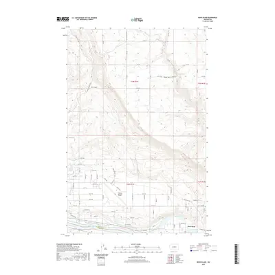
2020 Map of Rock Island
USGS Topo · Published 2020About this map
The town of Rock Island occupies a strategic position along the northern bank of the Rock Island Pool in the early twenty-first century. This landscape is defined by the sharp transition between the irrigated valley floors and the ascending elevations of Badger Mtn and the winding course of Sand Canyon. The local infrastructure is anchored by the Pangborn Memorial Airport, which sits on a plateau overlooking the Columbia River corridor.
Find a feature on this map
72 named features on this map. Tap any name to fly to it.
Don’t see what you’re looking for? This feature index may not catch every label — zoom into the map to look around manually.
Map Details
Editions of this 2020 Rock Island Map
This is the sole edition of this map. No revisions or reprints were ever made.
Other maps of this area

1901 · Chelan
USGS Topo · 1:125,000

1912 · Malaga
USGS Topo · 1:48,000

1913 · Wenatchee
USGS Topo · 1:62,500

1914 · Malaga
USGS Topo · 1:62,500

1915 · Wenatchee
USGS Topo · 1:62,500

1920 · Colockum Pass
USGS Topo · 1:125,000

1922 · Colockum Pass
USGS Topo · 1:125,000

1957 · Wenatchee
USGS Topo · 1:250,000
1966 · Malaga NE
USGS Topo · 1:24,000

1966 · Rock Island
USGS Topo · 1:24,000