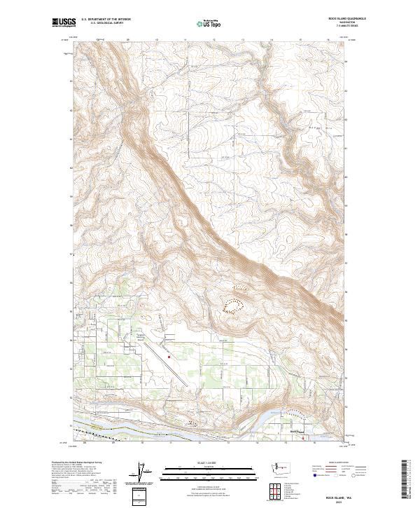
2023 Map of Rock Island
USGS Topo · Published 2023About this map
Rock Island sits at the base of a dramatic elevation gain toward Badger Mtn, where the landscape transitions from the developed riverfront to the high plateaus of the Columbia Basin. This 2023 survey illustrates the dense network of water management and irrigation vital to this region of Washington, specifically the Wenatchee Reclamation Ditch and its path along the Columbia River. The town itself is bounded by the Rock Island Pool, which includes several smaller water bodies like Blue Heron Lake, Hideaway Lake, and Putters Lake. To the west, the expansive grounds of Pangborn Memorial Airport dominate the terrace above the river, connected by a grid of numbered streets and thoroughfares such as Grant Rd and Airport Way. The map captures the interface between industrial infrastructure, aviation, and the natural drainage of Beaver Creek as it descends through the northern canyons.
Find a feature on this map
40 named features on this map. Tap any name to fly to it.
Don’t see what you’re looking for? This feature index may not catch every label — zoom into the map to look around manually.
Map Details
Editions of this 2023 Rock Island Map
This is the sole edition of this map. No revisions or reprints were ever made.
Other maps of this area

1901 · Chelan
USGS Topo · 1:125,000

1912 · Malaga
USGS Topo · 1:48,000

1913 · Wenatchee
USGS Topo · 1:62,500

1914 · Malaga
USGS Topo · 1:62,500

1915 · Wenatchee
USGS Topo · 1:62,500

1920 · Colockum Pass
USGS Topo · 1:125,000

1922 · Colockum Pass
USGS Topo · 1:125,000

1957 · Wenatchee
USGS Topo · 1:250,000
1966 · Malaga NE
USGS Topo · 1:24,000

1966 · Rock Island
USGS Topo · 1:24,000