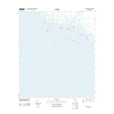
2012 Map of Rock Islands
USGS Topo · Published 2012About this map
The Gulf of Mexico coastline in Taylor County is defined by a complex network of marshy tidal creeks and low-lying coastal islands. The Fenholloway River and Henderson River discharge into the gulf here, creating an intricate shoreline where the terrestrial and aquatic worlds merge. Navigational markers like the Fenholloway River Approach Light indicate the importance of these waters for local maritime access, while inland, the landscape is fractured by Cedar Island Bayou and Pinhook Cr. Small landforms such as Rock Island, Little Grassy Island, and Big Grassy Island dot the nearshore environment. This 2012 survey illustrates the natural state of the Big Bend region, where the absence of developed roads or settlements highlights a coastline preserved in its primitive, water-dominated form, further evidenced by the extensive Oyster Bars and Bird Rock formations offshore.
Find a feature on this map
15 named features on this map. Tap any name to fly to it.
Don’t see what you’re looking for? This feature index may not catch every label — zoom into the map to look around manually.
Map Details
Editions of this 2012 Rock Islands Map
This is the sole edition of this map. No revisions or reprints were ever made.
Other maps of this area

1954 · Hampton Springs
USGS Topo · 1:24,000

1954 · Okefenokee Slough
USGS Topo · 1:24,000

1954 · Gainesville
USGS Topo · 1:250,000

1954 · Valdosta
USGS Topo · 1:250,000

1955 · Snipe Island
USGS Topo · 1:24,000

1955 · Rock Islands
USGS Topo · 1:24,000

1955 · Manlin Hammock
USGS Topo · 1:24,000
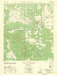
1956 · Hampton Springs
USGS Topo · 1:25,000

1958 · Valdosta
USGS Topo · 1:250,000

1958 · Gainesville
USGS Topo · 1:250,000