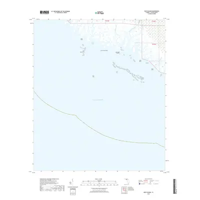
2018 Map of Rock Islands
USGS Topo · Published 2018About this map
Rock Islands and the labyrinthine marshlands of Taylor County define this coastal landscape where the land dissolves into the Gulf of Mexico. The area is characterized by a complex network of tidal waterways, including the Fenholloway River and the Pinhook River, which meander through extensive wetlands. This environment is punctuated by scattered coastal features like Stake Point and Bird Rock, illustrating the delicate transition between the Floridian mainland and the open sea.
Find a feature on this map
18 named features on this map. Tap any name to fly to it.
Don’t see what you’re looking for? This feature index may not catch every label — zoom into the map to look around manually.
Map Details
Editions of this 2018 Rock Islands Map
This is the sole edition of this map. No revisions or reprints were ever made.
Other maps of this area

1954 · Hampton Springs
USGS Topo · 1:24,000

1954 · Okefenokee Slough
USGS Topo · 1:24,000

1954 · Gainesville
USGS Topo · 1:250,000

1954 · Valdosta
USGS Topo · 1:250,000

1955 · Snipe Island
USGS Topo · 1:24,000

1955 · Rock Islands
USGS Topo · 1:24,000

1955 · Manlin Hammock
USGS Topo · 1:24,000
1956 · Hampton Springs
USGS Topo · 1:25,000

1958 · Valdosta
USGS Topo · 1:250,000

1958 · Gainesville
USGS Topo · 1:250,000