
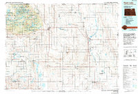
1985 Map of Rock Lake
USGS Topo · Published 1986About this map
The Turtle Mountains dominate the northwestern landscape of this mid-1980s survey, housing the Turtle Mountain Indian Reservation and the community of Belcourt. This elevation-rich region is dotted with numerous small bodies of water, including Carpenter Lake, Hooker Lake, and Jarvis Lake, reflecting a glacial topography distinct from the surrounding prairie. To the north, the international boundary with Manitoba is marked by a Port of Entry U S Customs near Saint John, emphasizing the area's cross-border connectivity.
Find a feature on this map
77 named features on this map. Tap any name to fly to it.
Don’t see what you’re looking for? This feature index may not catch every label — zoom into the map to look around manually.
Map Details
Editions of this 1985 Rock Lake Map
2 editions found
Other maps of this area

1935 · Dunseith
USGS Topo · 1:48,000

1936 · Lake Upsilon
USGS Topo · 1:48,000

1939 · Dunseith
USGS Topo · 1:62,500

1942 · Lake Upsilon
USGS Topo · 1:62,500

1953 · Devils Lake
USGS Topo · 1:250,000

1954 · Overly SE
USGS Topo · 1:24,000

1954 · Rugby NW
USGS Topo · 1:24,000

1954 · Leverich
USGS Topo · 1:24,000

1954 · Minot
USGS Topo · 1:250,000

1955 · Fonda
USGS Topo · 1:24,000