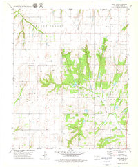
1979 Map of Rock Mary
USGS Topo · Published 1979About this map
Rock Mary, a prominent sandstone landmark and historic trail marker, rises above the red soil of Caddo County in this late-1970s survey. The landscape is defined by the transition from agricultural valley floors to the high, broken ground of Mound Valley and Lone Mound. Water sources like Dead Woman Creek and Sugar Creek carve through the terrain, while the local community is anchored by the Cedar Valley Ch and the small settlement at Sickles. This era of the landscape reveals a growing energy infrastructure, evidenced by the numerous Oil Wells and Gas Wells scattered across the township lines. The presence of a small Landing Strip and the crossroad at Ferns illustrate the practical transportation network serving this rural Oklahoma interior before modern developments altered the local character.
Find a feature on this map
13 named features on this map. Tap any name to fly to it.
Don’t see what you’re looking for? This feature index may not catch every label — zoom into the map to look around manually.
Map Details
Editions of this 1979 Rock Mary Map
2 editions found
Other maps of this area

1942 · Geary
USGS Topo · 1:62,500

1951 · Binger
USGS Topo · 1:62,500

1955 · Clinton
USGS Topo · 1:250,000

1957 · Clinton
USGS Topo · 1:250,000

1961 · Eakly
USGS Topo · 1:62,500

1964 · Weatherford
USGS Topo · 1:62,500

1979 · Hinton
USGS Topo · 1:24,000

1979 · Sickles
USGS Topo · 1:24,000
1979 · Binger
USGS Topo · 1:24,000
1979 · Geary South
USGS Topo · 1:24,000