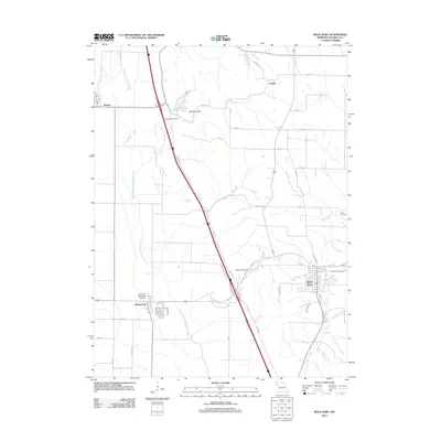
2012 Map of Rock Port
USGS Topo · Published 2012About this map
Rock Port serves as a primary hub of settlement in this northern Missouri landscape, situated near the winding course of Rock Creek. The geography is defined by the complex water systems of the Missouri River floodplain, most notably the Old Channel Nishnabotna River, which traces a legacy of shifting riverbanks and historical drainage patterns. To the north, the small community of Watson and the area near Linden sit amidst a grid of rural roads like Geneva Rd and 165th St. Genealogists will find significant value in the detailed location of local burying grounds, including Green Hill Cemetery, Addington Cemetery, Millsap Cemetery, and Smith Cemetery. The map also captures modern infrastructure such as the Rock Port Municipal Airport and the recreational waters of Charity Lake near Brickyard Hill.
Find a feature on this map
41 named features on this map. Tap any name to fly to it.
Don’t see what you’re looking for? This feature index may not catch every label — zoom into the map to look around manually.
Map Details
Editions of this 2012 Rock Port Map
This is the sole edition of this map. No revisions or reprints were ever made.
Other maps of this area

1915 · Nemaha
USGS Topo · 1:62,500

1936 · Fairfax
USGS Topo · 1:24,000

1939 · Tarkio
USGS Topo · 1:62,500

1939 · Farragut
USGS Topo · 1:62,500

1939 · Hamburg
USGS Topo · 1:62,500

1939 · Nemaha
USGS Topo · 1:62,500

1940 · Tarkio
USGS Topo · 1:62,500

1940 · Farragut
USGS Topo · 1:62,500

1941 · Tarkio
USGS Topo · 1:62,500

1941 · Hamburg
USGS Topo · 1:62,500