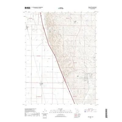
2017 Map of Rock Port
USGS Topo · Published 2017About this map
Rock Port serves as the focal point of this Northwest Missouri landscape, situated where the loess bluffs meet the Missouri River floodplain. The topography is defined by the contrast between the flat alluvial plains to the west, marked by the Old Channel Nishnabotna River, and the steep, dissected hills to the east. Brickyard Hill and Charity Lake highlight the recreational and natural character of the higher ground, while the valley floor is occupied by the small communities of Phelps City and Watson. Local history and genealogy are well-represented by numerous burial grounds scattered across the terrain, including Elmwood Cem, Linden Cem, and Addington Cem. The map traces the drainage patterns of Rock Cr and Boney Br as they flow through the county seat, providing a detailed look at the rural road network and township boundaries of Atchison County.
Find a feature on this map
67 named features on this map. Tap any name to fly to it.
Don’t see what you’re looking for? This feature index may not catch every label — zoom into the map to look around manually.
Map Details
Editions of this 2017 Rock Port Map
This is the sole edition of this map. No revisions or reprints were ever made.
Other maps of this area

1915 · Nemaha
USGS Topo · 1:62,500

1936 · Fairfax
USGS Topo · 1:24,000

1939 · Tarkio
USGS Topo · 1:62,500

1939 · Farragut
USGS Topo · 1:62,500

1939 · Hamburg
USGS Topo · 1:62,500

1939 · Nemaha
USGS Topo · 1:62,500

1940 · Tarkio
USGS Topo · 1:62,500

1940 · Farragut
USGS Topo · 1:62,500

1941 · Tarkio
USGS Topo · 1:62,500

1941 · Hamburg
USGS Topo · 1:62,500