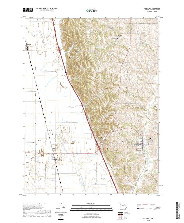
2021 Map of Rock Port
USGS Topo · Published 2021About this map
Rock Port serves as the focal point of this Northwest Missouri survey, home to the Atchison County Courthouse and a cluster of local landmarks like Green Hill Cem and Elmwood Cem. The landscape is defined by the sweeping course of the Old Channel Nishnabotna River, which meanders through the western lowlands near Phelps City and Watson. To the north, the terrain rises toward Brickyard Hill and the small settlement of Linden. This geographic layout highlights the traditional Missouri river-town economy, where transportation routes like State HWY B and State HWY D connect rural burial grounds and smaller communities to the county seat. Notable water features including Charity Lake and Rock Cr drain the eastern hills, while smaller tributaries like Boney Br and Volger Br cut through the local topography. This 2021 snapshot preserves the modern configuration of long-standing family and community locations across Atchison County.
Find a feature on this map
58 named features on this map. Tap any name to fly to it.
Don’t see what you’re looking for? This feature index may not catch every label — zoom into the map to look around manually.
Map Details
Editions of this 2021 Rock Port Map
This is the sole edition of this map. No revisions or reprints were ever made.
Other maps of this area

1915 · Nemaha
USGS Topo · 1:62,500

1936 · Fairfax
USGS Topo · 1:24,000

1939 · Tarkio
USGS Topo · 1:62,500

1939 · Farragut
USGS Topo · 1:62,500

1939 · Hamburg
USGS Topo · 1:62,500

1939 · Nemaha
USGS Topo · 1:62,500

1940 · Tarkio
USGS Topo · 1:62,500

1940 · Farragut
USGS Topo · 1:62,500

1941 · Tarkio
USGS Topo · 1:62,500

1941 · Hamburg
USGS Topo · 1:62,500