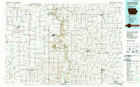
1985 Map of Rock Rapids
USGS Topo · Published 1989About this map
The Big Sioux River serves as the winding boundary between Iowa and South Dakota, carving through a landscape of agricultural townships and established rail hubs during the mid-1980s. This survey captures a region defined by its educational and natural landmarks, including Northwestern College in Orange City and Dordt College in Sioux Center. The map documents a dense network of transportation, where the Illinois Central Gulf and Burlington Northern railroads intersect with local transit points like Lakewood Corner.
Find a feature on this map
134 named features on this map. Tap any name to fly to it.
Don’t see what you’re looking for? This feature index may not catch every label — zoom into the map to look around manually.
Map Details
Editions of this 1985 Rock Rapids Map
2 editions found
Other maps of this area

1897 · Canton
USGS Topo · 1:125,000

1898 · Parker
USGS Topo · 1:125,000

1898 · Elk Point
USGS Topo · 1:125,000

1900 · Canton
USGS Topo · 1:125,000

1901 · Elk Point
USGS Topo · 1:125,000

1907 · Elk Point
USGS Topo · 1:125,000

1954 · Fairmont
USGS Topo · 1:250,000

1954 · Fort Dodge
USGS Topo · 1:250,000

1955 · Sioux City
USGS Topo · 1:250,000

1955 · Sioux Falls
USGS Topo · 1:250,000