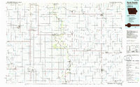
1985 Map of Rock Rapids
USGS Topo · Published 1985About this map
The Big Sioux River serves as the winding border between South Dakota and Iowa in this 1985 survey, defining the landscape and settlement patterns of the region. This transition zone features the established river towns of Canton and Hudson, which anchor the agricultural hinterland. The map reveals a highly structured grid of section lines and rural roads, characteristic of the upper Midwest, interspersed with significant conservation areas such as Newton Hills State Park and the uniquely named Gitchie Manitou State Game Production Area near the northern border.
Find a feature on this map
85 named features on this map. Tap any name to fly to it.
Don’t see what you’re looking for? This feature index may not catch every label — zoom into the map to look around manually.
Map Details
Editions of this 1985 Rock Rapids Map
2 editions found
Other maps of this area

1897 · Canton
USGS Topo · 1:125,000

1898 · Parker
USGS Topo · 1:125,000

1898 · Elk Point
USGS Topo · 1:125,000

1900 · Canton
USGS Topo · 1:125,000

1901 · Elk Point
USGS Topo · 1:125,000

1907 · Elk Point
USGS Topo · 1:125,000

1954 · Fairmont
USGS Topo · 1:250,000

1954 · Fort Dodge
USGS Topo · 1:250,000

1955 · Sioux City
USGS Topo · 1:250,000

1955 · Sioux Falls
USGS Topo · 1:250,000