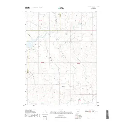
2019 Map of Rock Spring Gulch
USGS Topo · Published 2019About this map
Elk Head Reservoir defines the western edge of this Colorado high country landscape, where the waters of Elkhead Creek are impounded along the border of Moffat and Routt counties. The terrain is a complex network of steep drainage systems, including Rock Spring Gulch, Buck Gulch, and Jimmy Dunn Gulch, which all eventually feed south toward the Yampa River. Modern access is provided by a grid of rural roads like Co RD 29 and Co RD 78, alongside recreational paths such as the N End Trail and Lake View Loop near the reservoir. The map reveals a land divided by traditional survey townships, with labels such as McGuire Ln and Homesteader Ln hinting at the ranching and settlement history of this dissected plateau region.
Find a feature on this map
42 named features on this map. Tap any name to fly to it.
Don’t see what you’re looking for? This feature index may not catch every label — zoom into the map to look around manually.
Map Details
Editions of this 2019 Rock Spring Gulch Map
This is the sole edition of this map. No revisions or reprints were ever made.
Other maps of this area

1916 · Daton Peak
USGS Topo · 1:62,500

1920 · Daton Peak
USGS Topo · 1:62,500

1923 · Elkhead Creek
USGS Topo · 1:62,500

1923 · Pilot Knob
USGS Topo · 1:62,500

1924 · Elkhead Creek
USGS Topo · 1:62,500

1924 · Mt. Harris
USGS Topo · 1:48,000

1925 · Pilot Knob
USGS Topo · 1:62,500

1926 · Mount Harris
USGS Topo · 1:62,500

1954 · Craig
USGS Topo · 1:250,000

1957 · Craig
USGS Topo · 1:250,000