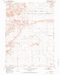
1950 Map of Rockeagle
USGS Topo · Published 1973About this map
Fort Laramie Military Reservation (Abandoned) occupies the northern landscape of this survey, illustrating the transition of former frontier defense lands into civil use. Situated within the distinct depression of the Goshen Hole and beneath the rising terrain of Harmony Heights, the area is defined by a sparse network of ranching infrastructure and isolated water sources. The small settlement of Rockeagle sits near the southern boundary, while the Old Doty Ranch Site near Cherry Creek provides a specific point of interest for researchers tracing the early cattle ranching history of Goshen County. Numerous Windmill labels scattered across the quadrangle highlight the essential role of groundwater in sustaining life on the high plains, particularly near landmarks like Doty Hill and Horseshoe Butte.
Find a feature on this map
10 named features on this map. Tap any name to fly to it.
Don’t see what you’re looking for? This feature index may not catch every label — zoom into the map to look around manually.
Map Details
Editions of this 1950 Rockeagle Map
5 editions found
Other maps of this area

1896 · Patrick
USGS Topo · 1:125,000

1896 · Hartville
USGS Topo · 1:125,000

1899 · Goshen Hole
USGS Topo · 1:125,000

1901 · Hartville
USGS Topo · 1:125,000

1950 · Rockeagle
USGS Topo · 1:24,000

1950 · Fort Laramie
USGS Topo · 1:24,000

1950 · Register Cliff
USGS Topo · 1:24,000

1951 · Eagles Nest
USGS Topo · 1:24,000

1952 · Register Cliff
USGS Topo · 1:24,000

1952 · Fort Laramie
USGS Topo · 1:24,000