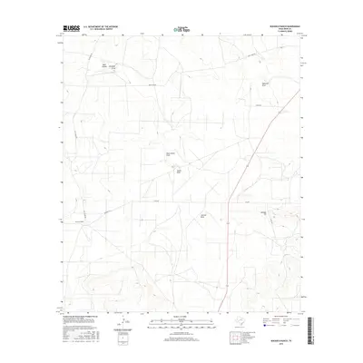
2016 Map of Rocker B Ranch
USGS Topo · Published 2016About this map
Rocker B Ranch defines the western portion of this Irion County landscape, situated within a complex network of ephemeral watercourses typical of the Edwards Plateau. The terrain is deeply inscribed by seasonal drainage patterns, most notably Tepee Draw and Rock Hollow Draw, which converge toward the center of the sheet. To the northeast, the land is characterized by McDowell Draw and the prominent rising of Johnson Hill. This area, primarily ranchland, is interconnected by a series of specialized routes including Salt House Rd and Lewis Trap Rd, reflecting the large-scale livestock operations of the region. The topography transitions from broad draws like Antelope Draw in the northwest to more dissected landforms near Johnson Draw, documenting the essential relationship between water access and Texas ranching infrastructure in the early 21st century.
Find a feature on this map
15 named features on this map. Tap any name to fly to it.
Don’t see what you’re looking for? This feature index may not catch every label — zoom into the map to look around manually.
Map Details
Editions of this 2016 Rocker B Ranch Map
This is the sole edition of this map. No revisions or reprints were ever made.
Other maps of this area

1920 · Big Lake
USGS Topo · 1:62,500

1920 · Barnhart
USGS Topo · 1:62,500

1921 · Ketchum Mountain
USGS Topo · 1:62,500

1922 · Big Lake
USGS Topo · 1:62,500

1922 · Barnhart
USGS Topo · 1:62,500

1923 · Ketchum Mountain
USGS Topo · 1:62,500

1954 · San Angelo
USGS Topo · 1:250,000

1958 · San Angelo
USGS Topo · 1:250,000

1965 · San Angelo
USGS Topo · 1:250,000

1970 · South Mustang Draw SE
USGS Topo · 1:24,000