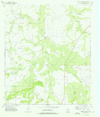
1973 Map of Rocker B Ranch
USGS Topo · Published 1976About this map
Rocker B Ranch and the surrounding west Texas landscape define this 1970s survey of Irion County. The map documents a rugged rangeland shaped by water management and resource extraction, where numerous cattle-tending features like the Antelope Line Camp and the Green Barn sit alongside a dense network of energy infrastructure. The arid terrain is carved by complex drainage systems, including Tepee Draw, Antelope Draw, and Johnson Draw, each dotted with critical water sources such as the Tepee Windmill, Elkins Windmill, and Windy Pt Windmill.
Find a feature on this map
22 named features on this map. Tap any name to fly to it.
Don’t see what you’re looking for? This feature index may not catch every label — zoom into the map to look around manually.
Map Details
Editions of this 1973 Rocker B Ranch Map
This is the sole edition of this map. No revisions or reprints were ever made.
Other maps of this area

1920 · Big Lake
USGS Topo · 1:62,500

1920 · Barnhart
USGS Topo · 1:62,500

1921 · Ketchum Mountain
USGS Topo · 1:62,500

1922 · Big Lake
USGS Topo · 1:62,500

1922 · Barnhart
USGS Topo · 1:62,500

1923 · Ketchum Mountain
USGS Topo · 1:62,500

1954 · San Angelo
USGS Topo · 1:250,000

1958 · San Angelo
USGS Topo · 1:250,000

1965 · San Angelo
USGS Topo · 1:250,000

1970 · South Mustang Draw SE
USGS Topo · 1:24,000