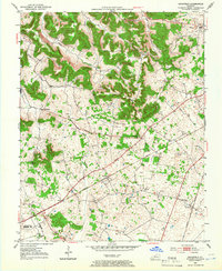
1952 Map of Rockfield
USGS Topo · Published 1966About this map
Rockfield and Rich Pond anchor this 1950s landscape in Warren County, where the Louisville and Nashville railroad corridor defines the local settlement pattern. The map reveals an area dense with family and community history, evidenced by numerous small burial grounds and rural institutions such as Cedar Grove Ch, Millikens Chapel, and the Salem Sch. The northern portion of the quadrangle is marked by significant topographic relief, including Briggs Hill and the winding course of Ivy Branch, while the south opens into flatter agricultural lands.
Find a feature on this map
25 named features on this map. Tap any name to fly to it.
Don’t see what you’re looking for? This feature index may not catch every label — zoom into the map to look around manually.
Map Details
Editions of this 1952 Rockfield Map
2 editions found
Other maps of this area

1914 · Little Muddy
USGS Topo · 1:62,500

1921 · Bowling Green
USGS Topo · 1:62,500

1922 · Brownsville
USGS Topo · 1:62,500

1923 · Bowling Green
USGS Topo · 1:62,500

1923 · Brownsville
USGS Topo · 1:62,500

1951 · Woodburn
USGS Topo · 1:24,000

1951 · Auburn
USGS Topo · 1:24,000

1951 · South Union
USGS Topo · 1:24,000

1952 · Rockfield
USGS Topo · 1:24,000

1954 · Evansville
USGS Topo · 1:250,000