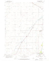
1955 Map of Rockford
USGS Topo · Published 1976About this map
Agricultural development and irrigation infrastructure dominate this mid-century survey of the Snake River Plain. The small communities of Rockford and Liberty serve as anchors within a landscape defined by an extensive network of waterways, including the Aberdeen Springfield Canal, Rockford Canal, and Peoples Canal. This sophisticated water management system allowed for the cultivation of Idaho's volcanic soils, while the Union Pacific railroad provided a vital link for moving goods through the region.
Find a feature on this map
19 named features on this map. Tap any name to fly to it.
Don’t see what you’re looking for? This feature index may not catch every label — zoom into the map to look around manually.
Map Details
Editions of this 1955 Rockford Map
2 editions found
Other maps of this area

1940 · Blackfoot
USGS Topo · 1:62,500

1943 · Blackfoot
USGS Topo · 1:62,500

1955 · Springfield NW
USGS Topo · 1:24,000

1955 · Baldy Knoll
USGS Topo · 1:24,000

1955 · Rockford
USGS Topo · 1:24,000

1955 · Pingree
USGS Topo · 1:24,000

1955 · Springfield
USGS Topo · 1:24,000

1955 · Idaho Falls
USGS Topo · 1:250,000

1958 · Idaho Falls
USGS Topo · 1:250,000
1971 · Fort Hall
USGS Topo · 1:24,000