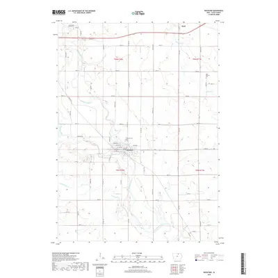
2018 Map of Rockford
USGS Topo · Published 2018About this map
The confluence of the Winnebago River and Shell Rock River defines the landscape surrounding the city of Rockford. This 2018 survey illustrates a classic northern Iowa agricultural grid, with rural roads like Red Ball RD and Echo Ave connecting the primary settlements. To the north, the town of Rudd is situated near the upper reaches of Flood Creek, serving as a secondary hub for the surrounding township.
Find a feature on this map
54 named features on this map. Tap any name to fly to it.
Don’t see what you’re looking for? This feature index may not catch every label — zoom into the map to look around manually.
Map Details
Editions of this 2018 Rockford Map
This is the sole edition of this map. No revisions or reprints were ever made.
Other maps of this area

1954 · Mason City
USGS Topo · 1:250,000

1954 · Waterloo
USGS Topo · 1:250,000

1955 · Waterloo
USGS Topo · 1:250,000

1957 · Mason City
USGS Topo · 1:250,000

1958 · Mason City
USGS Topo · 1:250,000

1959 · Mason City
USGS Topo · 1:62,500

1959 · Nora Springs
USGS Topo · 1:24,000

1959 · Mason City SE
USGS Topo · 1:24,000

1971 · Rockford
USGS Topo · 1:24,000

1971 · Orchard
USGS Topo · 1:24,000