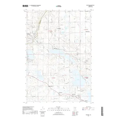
2019 Map of Rockford
USGS Topo · Published 2019About this map
Rockford straddles the line between Wright Co and Hennepin Co, anchoring a landscape defined by an dense network of glacial lakes and wetlands. The Crow River winds along the western edge, while the interior is dotted with prominent water bodies like Lake Sarah, Lake Independence, and Lake Rebecca. This late-period survey reflects the transition from rural agricultural land to more established residential and recreational use, evidenced by the numerous named roads like Kochs Xing and Babcock Blvd that weave between smaller settlements such as Burschville, Greenfield, and Loretto.
Find a feature on this map
77 named features on this map. Tap any name to fly to it.
Don’t see what you’re looking for? This feature index may not catch every label — zoom into the map to look around manually.
Map Details
Editions of this 2019 Rockford Map
This is the sole edition of this map. No revisions or reprints were ever made.
Other maps of this area

1905 · Minnetonka
USGS Topo · 1:62,500

1907 · Minnetonka
USGS Topo · 1:62,500

1909 · Rockford
USGS Topo · 1:62,500

1953 · Saint Paul
USGS Topo · 1:250,000

1953 · Stillwater
USGS Topo · 1:250,000

1955 · Stillwater
USGS Topo · 1:250,000

1957 · Waconia
USGS Topo · 1:62,500

1958 · Stillwater
USGS Topo · 1:250,000

1958 · Rockford
USGS Topo · 1:62,500

1958 · Mound
USGS Topo · 1:24,000