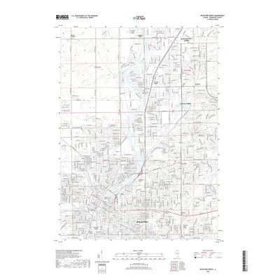
2018 Map of Rockford North
USGS Topo · Published 2018About this map
The Rock River corridor defines the geography of northern Illinois in this late 2010s survey, where the urban landscape of Rockford transitions into the suburban and residential communities of Loves Park, Machesney Park, and North Park. This map is particularly notable for its dense cluster of historical burial grounds along the river bluffs, including the sprawling Greenwood Cem, Rockford Hebrew Cem, and the adjacent Saint Marys and Saint James Cem.
Find a feature on this map
48 named features on this map. Tap any name to fly to it.
Don’t see what you’re looking for? This feature index may not catch every label — zoom into the map to look around manually.
Map Details
Editions of this 2018 Rockford North Map
This is the sole edition of this map. No revisions or reprints were ever made.
Other maps of this area

1917 · Kings
USGS Topo · 1:62,500

1918 · Rockford
USGS Topo · 1:62,500

1918 · Belvidere
USGS Topo · 1:62,500

1918 · Kings
USGS Topo · 1:62,500

1918 · Kirkland
USGS Topo · 1:62,500

1938 · Rockford
USGS Topo · 1:62,500

1944 · Belvidere
USGS Topo · 1:62,500

1949 · Camp Grant
USGS Topo · 1:24,000

1949 · Rockford
USGS Topo · 1:24,000

1954 · Rockford
USGS Topo · 1:250,000