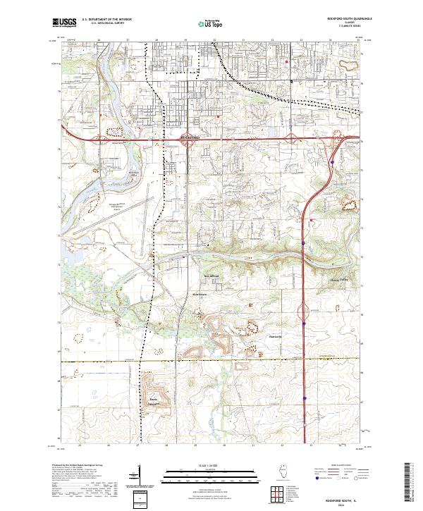
2024 Map of Rockford South
USGS Topo · Published 2024About this map
The Rock River and Kishwaukee River converge in this industrial and aviation corridor south of Rockford. This contemporary survey details the expansive footprint of the Chicago/Rockford International Airport, which dominates the landscape west of New Milford. The map provides a clear view of the transition from dense urban street grids near Union Cem to the open agricultural lands of the Winnebago and Ogle County border. Smaller communities like Morristown, Harrisville, and Davis Junction are mapped alongside significant landmarks such as Blackhawk Island and Cherry Valley. For local historians and genealogists, the inclusion of Milford Cem and the intricate drainage patterns of Killbuck Creek offer essential geographic context for tracing family roots and land ownership in northern Illinois.
Find a feature on this map
218 named features on this map. Tap any name to fly to it.
Don’t see what you’re looking for? This feature index may not catch every label — zoom into the map to look around manually.
Map Details
Editions of this 2024 Rockford South Map
This is the sole edition of this map. No revisions or reprints were ever made.
Other maps of this area

1917 · Kings
USGS Topo · 1:62,500

1918 · Rockford
USGS Topo · 1:62,500

1918 · Belvidere
USGS Topo · 1:62,500

1918 · Kings
USGS Topo · 1:62,500

1918 · Kirkland
USGS Topo · 1:62,500

1938 · Rockford
USGS Topo · 1:62,500

1944 · Belvidere
USGS Topo · 1:62,500

1949 · Camp Grant
USGS Topo · 1:24,000

1949 · Rockford
USGS Topo · 1:24,000

1954 · Rockford
USGS Topo · 1:250,000