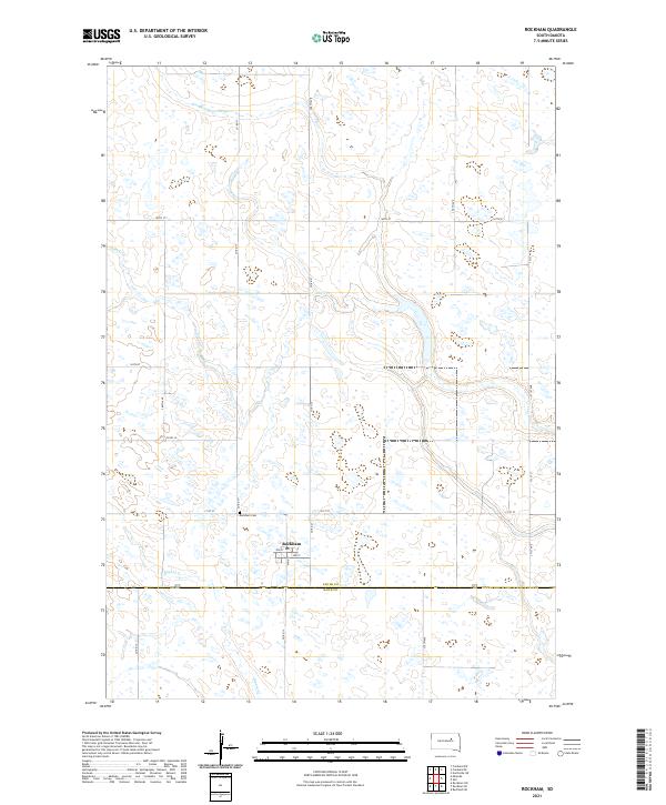
2021 Map of Rockham
USGS Topo · Published 2021About this map
The small town of Rockham serves as the central hub of this northern South Dakota landscape, situated just north of the Faulk Co and Hand Co boundary. This high-plains region is defined by a rhythmic grid of section lines, including Main St, 171st St, and Co Rd 17, which dictate the movement of agriculture and commerce across the prairie. The natural drainage of the land is visible through the meandering paths of Dove Cr and Bryant Cr, which cut through the otherwise orderly township and range divisions. For those tracing local heritage, the Rockham Cem is a significant landmark located just northwest of the town center, representing the long-standing community presence in this agricultural corridor near the turn of the twenty-first century.
Find a feature on this map
26 named features on this map. Tap any name to fly to it.
Don’t see what you’re looking for? This feature index may not catch every label — zoom into the map to look around manually.
Map Details
Editions of this 2021 Rockham Map
This is the sole edition of this map. No revisions or reprints were ever made.
Other maps of this area

1899 · Northville
USGS Topo · 1:125,000

1899 · Redfield
USGS Topo · 1:125,000

1953 · Huron
USGS Topo · 1:250,000

1954 · Aberdeen
USGS Topo · 1:250,000

1954 · Huron
USGS Topo · 1:250,000

1956 · Aberdeen
USGS Topo · 1:250,000

1966 · Cresbard SE
USGS Topo · 1:24,000
1966 · Miranda
USGS Topo · 1:24,000
1966 · Northville SW
USGS Topo · 1:24,000
1966 · Rockham SW
USGS Topo · 1:24,000