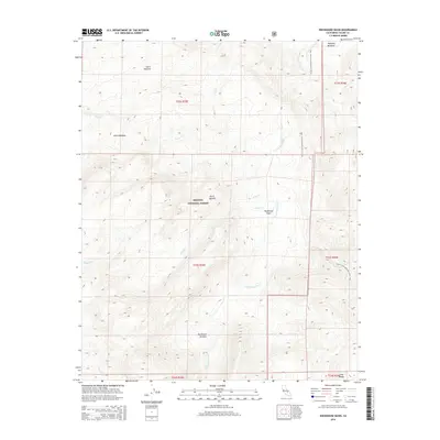
2015 Map of Rockhouse Basin
USGS Topo · Published 2015About this map
The S Fork Kern River cuts a deep path through the high-elevation wilderness of the Sierra Nevada on this 2015 topographic study of the Sequoia National Forest. The landscape is defined by the geological depression of the Rockhouse Basin, where various tributaries like Trout Cr, Fish Cr, and Tibbets Cr converge toward the main river channel. High mountain meadows provide unique landmarks in this roadless terrain, including Lunch Meadow to the north and the expansive Rockhouse Meadow situated along the lower river reach. A significant segment of the Pacific Crest National Scenic Trail traverses the eastern ridgelines, offering a record of the modern recreational footprint through these historic forest lands. This map is particularly valuable for tracing the drainage patterns and named meadows that have guided travelers through the southern reaches of the range for generations.
Find a feature on this map
19 named features on this map. Tap any name to fly to it.
Don’t see what you’re looking for? This feature index may not catch every label — zoom into the map to look around manually.
Map Details
Editions of this 2015 Rockhouse Basin Map
This is the sole edition of this map. No revisions or reprints were ever made.
Other maps of this area

1905 · Olancha
USGS Topo · 1:125,000

1906 · Kernville
USGS Topo · 1:125,000

1907 · Olancha
USGS Topo · 1:125,000

1908 · Kernville
USGS Topo · 1:125,000

1948 · Bakersfield
USGS Topo · 1:250,000

1948 · Fresno
USGS Topo · 1:250,000

1955 · Bakersfield
USGS Topo · 1:250,000

1955 · Fresno
USGS Topo · 1:250,000

1956 · Bakersfield
USGS Topo · 1:250,000

1956 · Fresno
USGS Topo · 1:250,000