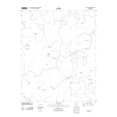
2011 Map of Rockhouse
USGS Topo · Published 2011About this map
The Kings River defines the landscape of this Arkansas survey, winding through a complex series of bends and hollows that historically dictated settlement patterns. The community of Rockhouse serves as the focal point, situated near the confluence of Rockhouse Creek and the river, with the nearby Rockhouse Cemetery offering a primary record for local genealogy. The map reveals an intricate network of county roads following the natural contours of the terrain, connecting family-named landmarks like Williams Hollow, Hollingsworth Hollow, and Reynolds Hollow.
Find a feature on this map
76 named features on this map. Tap any name to fly to it.
Don’t see what you’re looking for? This feature index may not catch every label — zoom into the map to look around manually.
Map Details
Editions of this 2011 Rockhouse Map
This is the sole edition of this map. No revisions or reprints were ever made.
Other maps of this area

1900 · Eureka Springs
USGS Topo · 1:125,000

1901 · Eureka Springs
USGS Topo · 1:125,000

1945 · Harrison
USGS Topo · 1:250,000

1949 · Harrison
USGS Topo · 1:250,000

1954 · Harrison
USGS Topo · 1:250,000
1957 · Mundell
USGS Topo · 1:24,000
1957 · Beaver
USGS Topo · 1:24,000
1958 · Hindsville
USGS Topo · 1:24,000
1958 · Harrison
USGS Topo · 1:250,000
1964 · Harrison
USGS Topo · 1:250,000