
1949 Map of Rockinstraw Mtn
USGS Topo · Published 1957About this map
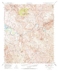
The Salt River carves a dramatic path through the center of this 1947 aerial survey, winding past the Horseshoe Bend before meeting the eastern reaches of the Roosevelt Reservoir. The landscape is dominated by the complex terrain of the Tonto National Forest, characterized by numerous named peaks like Rockinstraw Mtn and Salt River Peak. Resource management and early environmental research are evident through the inclusion of the Sierra Ancha Experimental Forest in the north and two distinct outposts for forest oversight: the A-Cross Ranger Sta and the Alamo Ranger Sta. Historically, the Richmond Basin in the southeast corner marks an area of significant geologic and prospecting interest, while the numerous springs and washes, such as Sycamore Springs and Pringle Wash, reveal the vital water sources that dictated movement through this arid Gila County terrain.
Find a feature on this map
71 named features on this map. Tap any name to fly to it.
Don’t see what you’re looking for? This feature index may not catch every label — zoom into the map to look around manually.
Map Details
Editions of this 1949 Rockinstraw Mtn Map
2 editions found
Other maps of this area

1900 · Florence
USGS Topo · 1:125,000

1901 · Globe
USGS Topo · 1:62,500

1902 · Globe
USGS Topo · 1:62,500

1902 · Florence
USGS Topo · 1:125,000

1907 · Roosevelt
USGS Topo · 1:125,000

1909 · Four Peaks
USGS Topo · 1:125,000

1912 · Roosevelt
USGS Topo · 1:125,000

1922 · Chrysotile
USGS Topo · 1:125,000

1945 · Globe
USGS Topo · 1:24,000

1945 · Inspiration
USGS Topo · 1:24,000