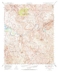
1949 Map of Rockinstraw Mtn
USGS Topo · Published 1968About this map
The Salt River carves a dramatic path through the center of this 1940s landscape, winding past the notable Horseshoe Bend and the Inspiration Dam (Aban'd). The terrain is defined by the high elevations of the Sierra Ancha to the north and the Pinal Mountains to the south, with the Apache Trail and Highway No 88 providing the primary transit routes through the canyon country. Regional management and early 20th-century history are visible through the presence of the A-Cross Ranger Sta and the Alamo Ranger Sta, situated within the expansive Tonto National Forest. Small-scale industrial activity is evidenced by scattered Mines and the Richmond Basin, while the northern portion of the map includes a section of the Fort Apache Indian Reservation and an Experimental Forest, signaling the area's significance for both natural resource study and indigenous lands.
Find a feature on this map
81 named features on this map. Tap any name to fly to it.
Don’t see what you’re looking for? This feature index may not catch every label — zoom into the map to look around manually.
Map Details
Editions of this 1949 Rockinstraw Mtn Map
2 editions found

Other maps of this area

1900 · Florence
USGS Topo · 1:125,000

1901 · Globe
USGS Topo · 1:62,500

1902 · Globe
USGS Topo · 1:62,500

1902 · Florence
USGS Topo · 1:125,000

1907 · Roosevelt
USGS Topo · 1:125,000

1909 · Four Peaks
USGS Topo · 1:125,000

1912 · Roosevelt
USGS Topo · 1:125,000

1922 · Chrysotile
USGS Topo · 1:125,000

1945 · Globe
USGS Topo · 1:24,000

1945 · Inspiration
USGS Topo · 1:24,000