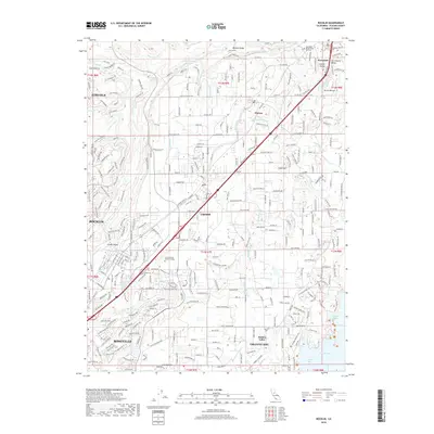
2018 Map of Rocklin
USGS Topo · Published 2018About this map
Boulder Ridge and the Sacramento Valley floor define the topographical transition of this Placer County landscape. The map captures a sophisticated network of water management infrastructure, where the Antelope Canal, Baughman Canal, and Morgan Canal wind through the burgeoning residential corridors of Roseville, Rocklin, and Loomis. This irrigation and drainage system, foundational to the region's development, connects the higher elevations of Newcastle and Penryn down toward the shores of Folsom Lake.
Find a feature on this map
323 named features on this map. Tap any name to fly to it.
Don’t see what you’re looking for? This feature index may not catch every label — zoom into the map to look around manually.
Map Details
Editions of this 2018 Rocklin Map
This is the sole edition of this map. No revisions or reprints were ever made.
Other maps of this area

1891 · Sacramento
USGS Topo · 1:125,000

1892 · Sacramento
USGS Topo · 1:125,000

1893 · Sacramento
USGS Topo · 1:125,000

1902 · Fairoaks
USGS Topo · 1:62,500

1910 · Lincoln
USGS Topo · 1:31,680

1910 · Roseville
USGS Topo · 1:31,680

1911 · Antelope
USGS Topo · 1:31,680

1914 · Folsom
USGS Topo · 1:31,680

1941 · Folsom
USGS Topo · 1:62,500
1942 · Markham Ravine
USGS Topo · 1:62,500