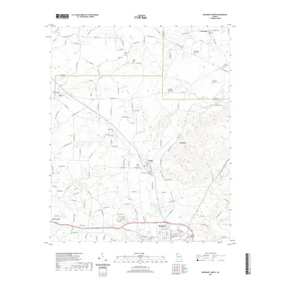
2020 Map of Rockmart North
USGS Topo · Published 2020About this map
Rockmart and the surrounding Georgia landscape are defined by the winding course of Euharlee Creek and a dense network of family and community cemeteries. The terrain transitions between the settlements of Aragon and Portland, where local roads like Taylorsville Rd and Old Alabama Rd connect scattered homesteads and parish churches. The presence of numerous burial grounds, including the Dickerson Family Cem and the Bethlehem Methodist Church Cem, provides a detailed record of the region's multigenerational residency. To the west, Pine Hill Lake sits near the Floyd County line, while smaller water features such as Jones Br and Fish Cr drain the undulating hills. This modern survey illustrates the persistent rural character of the area, where small communities like Seney and Crossroads remain distinct points in a landscape shaped by both small-scale agriculture and the convergence of Polk, Bartow, and Floyd counties.
Find a feature on this map
144 named features on this map. Tap any name to fly to it.
Don’t see what you’re looking for? This feature index may not catch every label — zoom into the map to look around manually.
Map Details
Editions of this 2020 Rockmart North Map
This is the sole edition of this map. No revisions or reprints were ever made.
Other maps of this area

1886 · Rome
USGS Topo · 1:125,000

1889 · Tallapoosa
USGS Topo · 1:125,000

1890 · Cartersville
USGS Topo · 1:125,000

1891 · Marietta
USGS Topo · 1:125,000

1891 · Cartersville
USGS Topo · 1:125,000

1892 · Tallapoosa
USGS Topo · 1:125,000

1895 · Marietta
USGS Topo · 1:125,000

1896 · Cartersville
USGS Topo · 1:125,000

1897 · Marietta
USGS Topo · 1:125,000

1897 · Tallapoosa
USGS Topo · 1:125,000