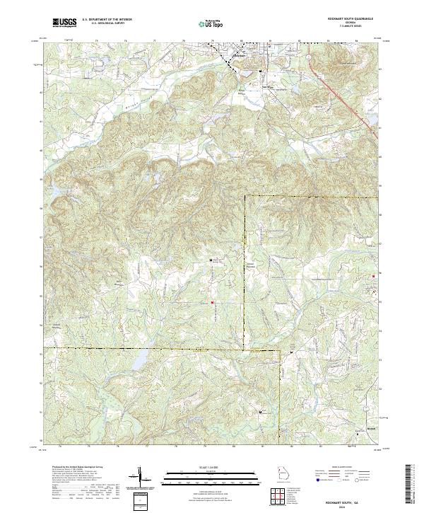
2024 Map of Rockmart South
USGS Topo · Published 2024About this map
Morgan Valley and the surrounding ridgelines define the landscape south of Rockmart, where the borders of Polk, Paulding, and Haralson counties converge. This modern survey shows a region where small communities like Van Wert and Beulah remain anchored by long-established landmarks, including the Van Wert Methodist Church Cem and several family or community burial grounds. The geography is characterized by numerous small peaks such as Signal Mountain, Paris Mountain, and Everett Mountain, separated by a dense network of watercourses including Euharlee Creek and the Tallapoosa River. The map captures the current state of rural land use, documenting local road networks like Government Farm Rd and Morgan Valley Rd that thread through the valleys and over the wooded summits of Vinson Mountain.
Find a feature on this map
138 named features on this map. Tap any name to fly to it.
Don’t see what you’re looking for? This feature index may not catch every label — zoom into the map to look around manually.
Map Details
Editions of this 2024 Rockmart South Map
This is the sole edition of this map. No revisions or reprints were ever made.
Other maps of this area

1886 · Rome
USGS Topo · 1:125,000

1889 · Tallapoosa
USGS Topo · 1:125,000

1890 · Cartersville
USGS Topo · 1:125,000

1891 · Marietta
USGS Topo · 1:125,000

1891 · Cartersville
USGS Topo · 1:125,000

1892 · Tallapoosa
USGS Topo · 1:125,000

1895 · Marietta
USGS Topo · 1:125,000

1896 · Cartersville
USGS Topo · 1:125,000

1897 · Marietta
USGS Topo · 1:125,000

1897 · Tallapoosa
USGS Topo · 1:125,000