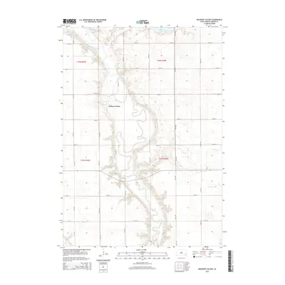
2015 Map of Rockport Colony
USGS Topo · Published 2015About this map
The winding James River dictates the landscape of Beulah Township in this mid-2010s survey, carving a deep valley through the prairie of Hanson County. Rockport Colony sits on the western bluffs overlooking a sharp bend in the river, anchored by a network of sectional roads and the prominent Tuttle Rd. The terrain is defined by the intersection of water and agriculture, with smaller tributaries like Bloom Cr and Pierre Cr feeding into the main river valley. To the north, Hanson Lake serves as a distinct hydrological feature amidst the geometric grid of 260th through 268th Streets. This map provides a clear look at the contemporary land divisions and the enduring relationship between communal settlements and the natural river corridor that has shaped this region of South Dakota for generations.
Find a feature on this map
25 named features on this map. Tap any name to fly to it.
Don’t see what you’re looking for? This feature index may not catch every label — zoom into the map to look around manually.
Map Details
Editions of this 2015 Rockport Colony Map
This is the sole edition of this map. No revisions or reprints were ever made.
Other maps of this area

1898 · Olivet
USGS Topo · 1:125,000

1899 · Alexandria
USGS Topo · 1:125,000

1955 · Sioux Falls
USGS Topo · 1:250,000

1957 · Alexandria
USGS Topo · 1:24,000

1957 · Ethan
USGS Topo · 1:24,000

1957 · Milltown
USGS Topo · 1:24,000

1957 · Clayton
USGS Topo · 1:24,000

1957 · Rockport Colony
USGS Topo · 1:24,000

1957 · Riverside
USGS Topo · 1:24,000

1958 · Sioux Falls
USGS Topo · 1:250,000
Featured Places
- Rockport Colony, SD
- Worthen Township, SD
- Rosedale Township, SD
- Wayne Township, SD
- Rockport Hutterite Colony, SD